Launch Party: LOGIC Magazine’s SCALE Issue, April 26

LOGIC MAGAZINE ISSUE 04: SCALE

7PM – WED APR 25, 2018
FREE AND OPEN TO THE PUBLIC – LIBERTY HALL, NEW YORK

RVSP Here

Talks include:

K. Sabeel Rahman on new tech monopolies and how to tame them

Nina Sparling
 on “open-source agriculture”

Ross Perlin
 on small languages, smartphones and the internet

Moira Weigel
 on #MeToo, the death of print media, and the structure of the internet

Ben Tarnoff
 on how data got “big”, and how we might democratize it

This event is organized by Logic Magazine. For the latest news and updates, check out their event page. Please note RSVP here is required to attend and your email may be shared with Logic for a one-time opt in request.

The Help-Yourself City, Book Launch Monday 3/26 @ 6pm at NYU

Logistics + RSVP on the Institute for Public Knowledge website

NYU’s Institute for Public Knowledge invites you to join for the launch of Gordon Douglas’s The Help-Yourself City: Legitimacy and Inequality in DIY Urbanism. The author will be present in conversation with Caroline Lee and Harvey Molotch.

When local governments neglect public services or community priorities, how do concerned citizens respond? In The Help-Yourself City, Gordon Douglas looks closely at people who take urban planning into their own hands with homemade signs and benches, guerrilla bike lanes and more. Douglas explores the frustration, creativity, and technical expertise behind these interventions, but also the position of privilege from which they often come. Presenting a needed analysis of this growing trend from vacant lots to city planning offices, The Help-Yourself City tells a street-level story of people’s relationships to their urban surroundings and the individualization of democratic responsibility.

Gordon C. C. Douglas is Assistant Professor of Urban Planning and Director of the Institute for Metropolitan Studies at San José State University. He is a multidisciplinary urbanist whose work sits at the intersection of urban political-economy, community studies, and cultures of planning and design. Prior to joining the Dept. of Urban and Regional Planning at San José State, he was the Rebuild by Design Postdoctoral Fellow at New York University, where he also served as Associate Director (2015-2016) and Acting Director (2016-2017) of the Institute for Public Knowledge.

Caroline W. Lee is Professor of Sociology in the Anthropology & Sociology Department at Lafayette College. She is a comparative institutional sociologist with research and teaching interests in the following areas: political sociology, social movements, economic sociology, law, sociology of knowledge and culture, urban and environmental sociology, and research methods. She is the author of Do-It-Yourself Democracy (Oxford University Press, 2015) and an editor of the volume Democratizing Inequalities (NYU Press, 2015).

Harvey Molotch is Professor of Sociology and Metropolitan Studies at New York University. His writings focus on cities with special attention to economic development, urban security, artifacts, and product design. He is the author of several books including Against Security: How We Go Wrong at Airports, Subways and Other Sites of Ambiguous Danger (Princeton University Press, 2012), and Where Stuff Comes From: How Toasters, Toilets, Cars, Computers and Many Other Things Come to Be as They Are (Routledge, 2003).

Being in Two Places at Once: Art + Geopolitics of Remote Sensing, 3/20 @ NYU

Being in Two Places at Once: Art and the geopolitics of remote sensing

Tuesday 20 March 2018 — 9:30am – 7pm
NYU Tisch Dean’s Conference Room
721 Broadway, 12th Floor

See Tisch website for Program + RSVP

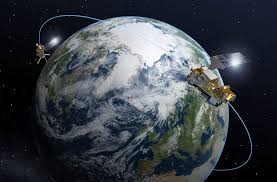
Scales and subjectivities of vision and photography are transforming under the influence of remote-sensing arrays, machine visions, and global observation systems. Computational and composite photography capture not just an image in time, but also in space, permitting 1:1 digitization and replication of spatial objects, bodies, and landscapes. Remote sensing offers at once extended apparatuses of viewing, feeling, and operating in the world, as well as expanded dynamics of population control. These large-scale spatial mapping technologies are primarily deployed, administered, and understood by economically dominant world powers and multinational scientific consortia. Asymmetrical power relations are thus reproduced and amplified at the planetary scale. There is an urgency for these images and models to be legible to wider publics and constituencies than solely at the levels of industry, military, and governance.

How can artists operate within these scales of perception for new imaginative and political potential? What kinds of interventions, trespasses, transformative subjectivities are occurring through the deliberate decolonization and appropriation of networks of remote sensing by those on the peripheries of power?

Model Cities Program @ UnionDocs, Thursday March 15 @ 7:30pm

Thursday, Mar 15 at 7:30 pm

What is the Model City?

Screening to be followed by a presentation by Susanne Schindler and a discussion with Schindler, Gordon Hyatt, and Rebecca Amato.

via UnionDocs

What was the Model Cities program and why have so few people heard about it? Join architect and historian Susanne Schindler as she explains the origins, trajectory and legacies of the Great Society program launched in 1966. Model Cities’ goal was to improve the quality of life in the nation’s most impoverished urban areas by coordinating federal funding and community participation. Despite the best intentions, however, the program’s implementation was rocky. By 1970 it was considered a problem, and in 1974 it was terminated. New York City had three Model Cities Neighborhoods—Central Brooklyn, the South Bronx, and Harlem–East Harlem—areas that today are once again highly contested in light of municipal planning policies.

The program will include a screening of Gordon Hyatt’s never-before-shown film, Between The Word And The Deed, followed by a discussion with the filmmaker as well as Rebecca Amato from NYU’s Urban Democracy Lab.

Catalogue — Adding Intelligences

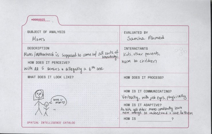
The building of our catalogue of spatial intelligences is an ongoing task. Below is the link to the template to download the card to fill out and catalogue other spatial intelligences that come to mind.

To add new entries to the catalog,
1— download a catalog card here;
2— fill it out, and choose the types of intelligence most pertinent to your chosen agent;
3— scan and crop it;
4— then upload it by creating a new post, selecting the scanned card as your “Featured Image,” choosing the “Catalogue of Urban Intelligences” category.